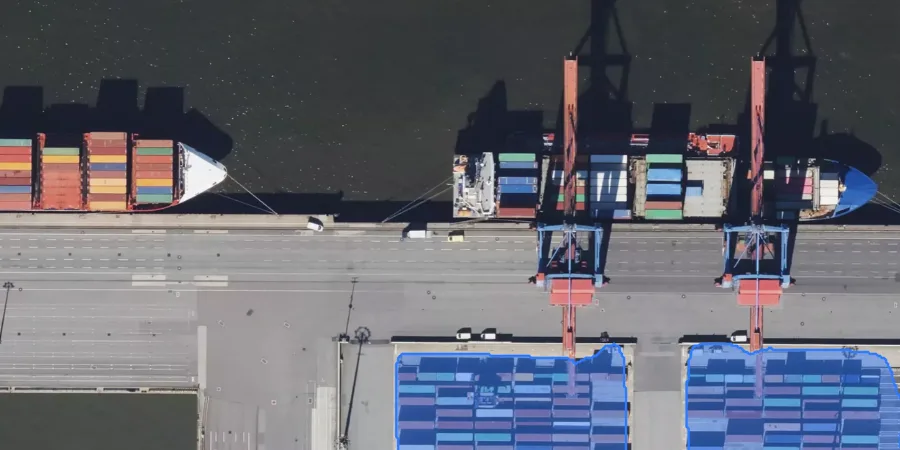
Port terminals
Track container areas, operational zones, and evolving layouts over time.
Detect objects in aerial or satellite imagery and generate precise geospatial polygons.
Nothing to install. No QGIS. Sign in, click, and go. Detect an area, segment it, refine it manually, then save and export your geofences.
Track container areas, operational zones, and evolving layouts over time.
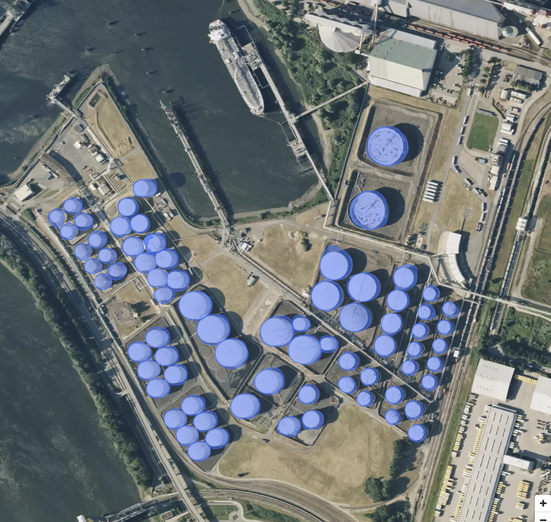
Detect storage tanks, industrial assets, and fenced perimeters across large sites.
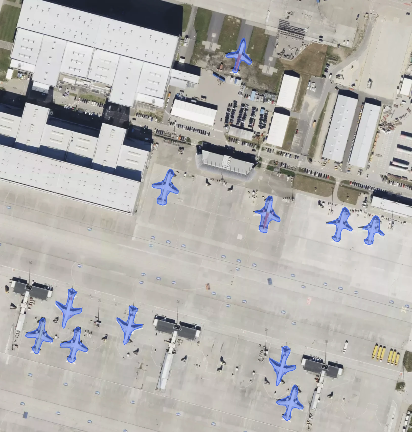
Track aircraft positions, apron activity, and secured zones across airbases.
Need full control? Deploy on-premise.
If you are an enterprise, GeoAI can be deployed on-premise under a licensing model.
Open the product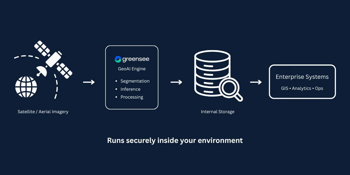
No. GeoAI is fully web-based, so the full workflow runs in your browser.
No. An account is required to use GeoAI.
GeoAI supports text prompts, positive or negative points, and hover preview for fast interactive detection.
Yes. Save geofences inside workspaces, then export them from the app in GeoJSON, KML, or GPX.
Yes. Enterprise customers can deploy GeoAI on-premise under a license.